Contact us
If you are interested, feel free to contact us!
We look forward to working together!
Mobile
Lőrinc Márkus
+36 20 275 7124
Máté Bene
+36 20 587 1138
Email
A forestry drone survey involves conducting traditional forestry measurements (such as tree counting, height measurement, diameter measurement, basal area, and volume calculation) automatically using geoinformatics tools. During our forestry surveys, data collection is carried out using a professional drone, and the measurements are processed by our proprietary automated software.
During our drone-based forestry surveys, we examine all the parameters that may be necessary for foresters to assess the designated area. Using our proprietary automated software, we detect all trees in the surveyed area, analyzing them individually.
We measure the height of each tree and determine its trunk diameter at a height of 1.3 meters. After measuring the trunk diameters, we calculate the basal area per hectare. Using these values along with known tree volume calculation tables, we calculate the volume of each specific tree, considering its height, diameter, and species (using the dominant tree species).
This process is repeated for each tree in the area, providing our clients with a comprehensive overview of the forested area. As a result, individual tree parameters can be analyzed, and the total volume of all trees in the area, as well as the basal area per hectare, can be determined. This is valuable information for forest inventory, potential logging, purchase, or forestry planning.
We recommend our drone-based forestry services to forest managers who seek accurate and reliable data about their forested areas, whether for inventory, logging, or pre-purchase surveys. Our service offers a fast, precise, and cost-effective solution for surveying forested areas.
TreeDetect provides simple and fast access to drone-based forestry surveys for both forest managers and drone pilots. The platform aims to make spatial data processing and forestry analytics clear, accessible, and easy to use for everyone.
Our drone-based forestry surveys are more efficient than traditional manual surveys because drones can access areas that are otherwise difficult to reach. Additionally, our drone surveys are exceptionally fast, allowing us to survey hundreds of hectares in a single day.
The duration of surveys can be a key factor, especially when larger areas need to be surveyed, which could take months with traditional methods. While most traditional surveys rely on statistical calculations and extrapolations, we measure each tree individually, maximizing the accuracy of the measurements compared to reality.
Our innovative surveys are also offered at much more competitive prices than traditional surveys, allowing our clients to save both time and money.
The first step in our workflow is to establish, in consultation with our client, the exact service package that best suits the desired outcome.
After the consultations, we prepare for on-site work, pre-programming the drone’s flight path and obtaining the necessary airspace permits.
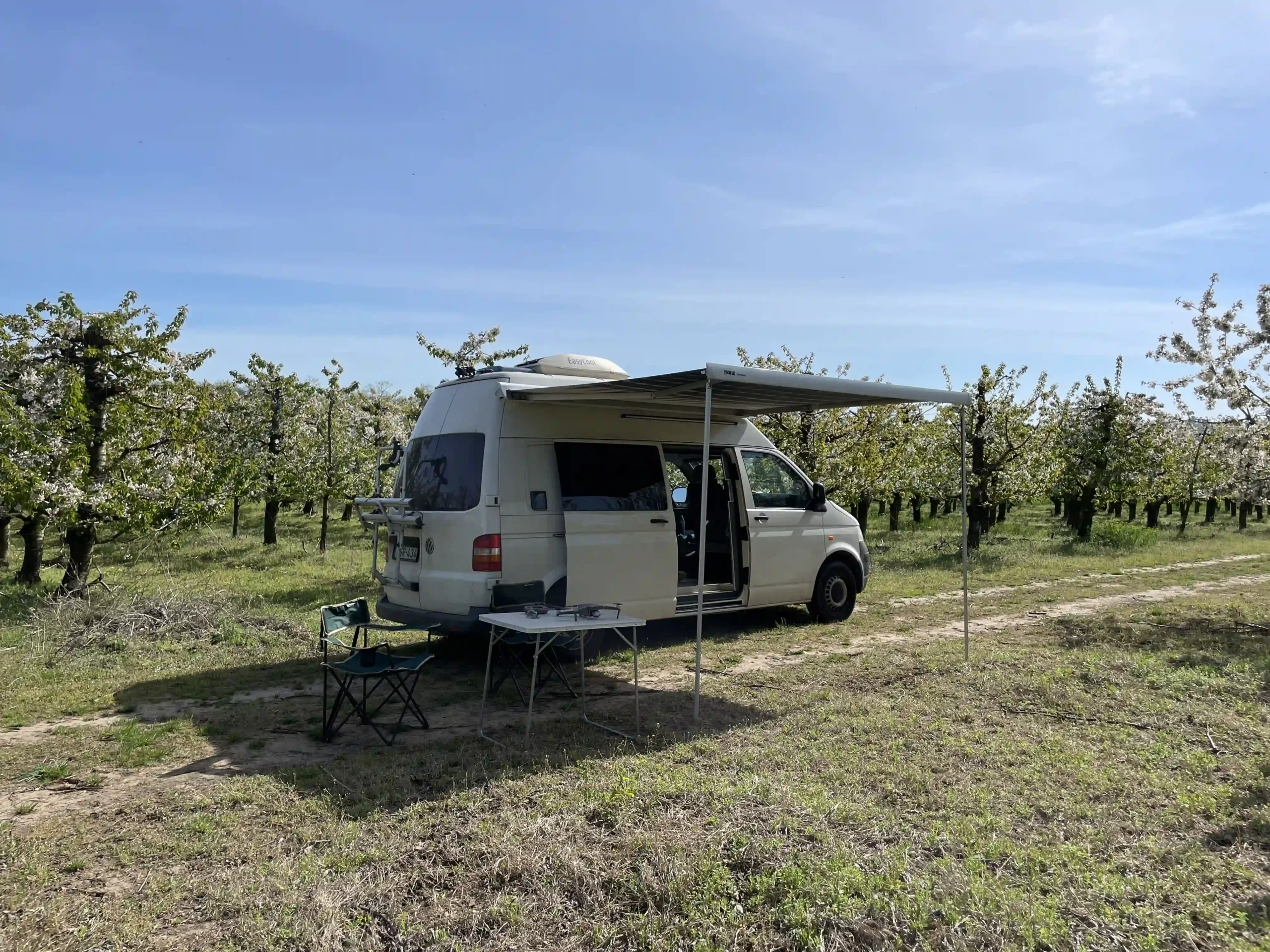
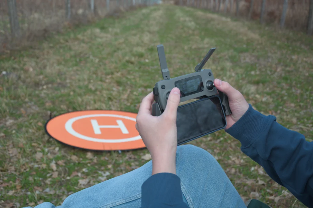
During the on-site survey, our team arrives at the location of the survey area and executes the pre-programmed flight plan. During the flight, we capture images at automatically determined tilt angles and overlaps. After the flight, the recorded data is checked.
The first step in processing is to create a highly detailed 3D point cloud of the designated forest area from the recorded data. The 3D point cloud is a digital replica of reality in color.
The 3D point cloud is created using photogrammetric methods to model as much data and detail as possible, including the trunks of trees, enabling measurements to be taken from them later.
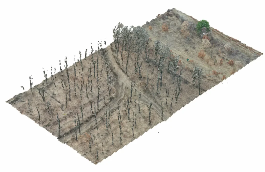
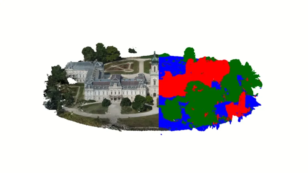
4. In the next step, we normalize the point cloud using our proprietary software and categorize different types of objects using a machine learning algorithm (e.g., ground surface, buildings, green areas, plants).
This step is necessary to ensure that subsequent measurements are focused only on the relevant objects—in this case, the trees.
In the measurement phase, we automatically detect the trees in the 3D point cloud using our proprietary software. After detecting the trees, we measure their height individually and the trunk diameter at a height of 1.3 meters. From the diameters, we determine the basal area per hectare, and using the tree species, we calculate each tree’s volume based on known tree volume calculation tables
These measurements are carried out for each tree, and after completing the measurements, we also define summary metrics (total volume, average height, etc.).
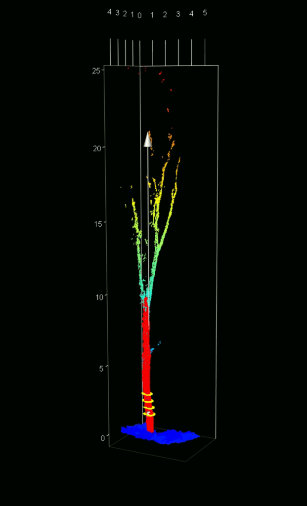
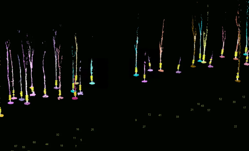
As a result, we provide our clients with a table that lists all trees in the area with the following parameters: unique tree identifier, tree coordinates, tree height, tree diameter, tree volume, and tree basal area. The table also includes the total tree volume in the area.
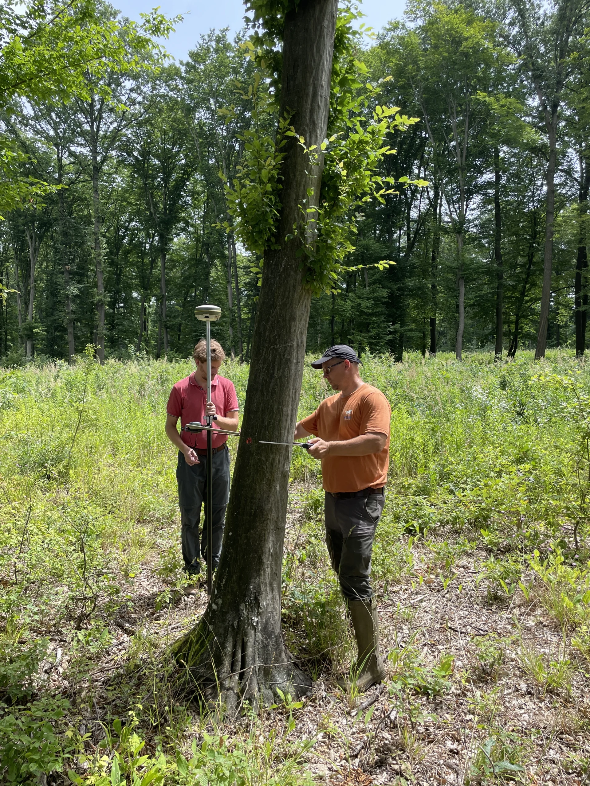
While designing our service package, we established close cooperation with Hungarian forestry experts, who supported us in verifying the accuracy of our surveys. We assessed the precision of our services through tests conducted on a 10-hectare forest area, achieving the following accuracy results.
While designing our service package, we established close cooperation with Hungarian forestry experts, who supported us in verifying the accuracy of our surveys. We assessed the precision of our services through tests conducted on a 10-hectare forest area, achieving the following accuracy results.
In the summer of 2023, we surveyed the entire District VI using a drone. We made a thermal and a regular orthophoto of the district using a thermal camera drone.
(Read more..)
In 2018, on behalf of an architectural firm, we made external orthophotos of the facades and the roof of the Hungarian National Bank using a drone.
For Ipoly Erdő Ltd., we surveyed more than 50 hectares of forest with a drone. Using our proprietary software we determined the number of trees, height, volume and basal area.
In 2023, we created colored 3D models of the newly introduced Herendi porcelains using photogrammetric methods. Some of these can be viewed on our website.
In 2018, in connection with the station’s renovation, we made external orthophotos of all the facades and the hall roof using a drone.
For Gyulaj Ltd., we have already surveyed more than 30 hectares of forest with a drone. During the drone forestry surveys we measured the number of trees, their height and volume.
On behalf of an architectural firm, we took external and overhead orthophotos of the office using a drone.
In 2022, in connection with the border crossing renovation, we created a basic aerial map of the entire border crossing and its surroundings using a drone.
In 2023, we made a virtual tour of one of PPG Trilak’s factories.
We have carried out several building surveys for LPP Hungary Kft. We created 3D laser scan point clouds and photographic documentation of the buildings.
In early 2024, we surveyed a petrol station’s advertising column using a laser scanner and a drone on behalf of Orlen Hungary Kft. The new advertising column will be built based on these surveys.
In 2019, we took external orthophotos with a drone of the internal medicine, neurology, and urology buildings located on the campus.
In addition to the ones mentioned above, we have numerous satisfied clients by our side.
We offer a free demo survey to all interested clients, during which we demonstrate our services and their outcomes on an area of approximately 1-5 hectares. The demo survey is entirely free; only the travel costs need to be covered. For information on the free demo survey, please contact us via the contact form, phone, or email.
If you are interested, feel free to contact us!
We look forward to working together!
Lőrinc Márkus
+36 20 275 7124
Máté Bene
+36 20 587 1138
Our drone-based forestry surveys allow for precise measurement of all parameters that may be important to a forester. Using our proprietary automated software, we determine the number of trees in the area and individually measure the height and diameter (at 1.3 meters) of each tree. Based on the collected data, and using the tree volume calculation tables, we calculate the volume of each tree separately, determine the total volume of all trees in the area, and calculate the basal area per hectare.
Our drone-based forestry surveys are completed much faster than traditional methods. Surveying a 10-hectare area takes only 29 minutes using our innovative technology. Data processing and measurements are typically completed within a few hours.
The exceptional accuracy of our drone-based forestry surveys is ensured by the fact that, unlike traditional methods, we do not rely on statistical estimates and extrapolations. During our surveys, each tree is individually measured using our proprietary automated software, capturing the actual data for the entire area.
The costs of our drone-based forestry surveys consist of two components. The unit price per hectare is determined based on the complexity and size of the area, while the travel cost depends on the location of the area. For a personalized quote, please contact us via the contact form, phone, or email, and we will prepare a tailored offer within one business day.
The drone-based forestry survey services we offer can only be conducted when the trees are leafless, typically between November and March. An exception to this rule is areas covered with evergreen trees, which can be surveyed throughout the year.
Provide your email address or phone number, and our colleague will contact you within 1 hour.
